Data! Planned is an overlay showing GPS positions from the Digital Falcon flights. How to use it.
The absence of good Farm management software is obvious.
Taking advantage of aerial imaging in managing your truffière
You’ve all looked at your property or intended block on Google Maps. Now imagine starting from a basic photographic image like that, with added depth information from GPS, either from commercial sources or a drone flight over your property, you can overlay contours, plan planting rows. It is also possible to create an interactive way to map your production output from your individual trees. It’s even possible to use your smartphone and enter data in the field for collation later. We have a data logger project underway that will allow a handheld GPS position for your individual tree as you harvest.

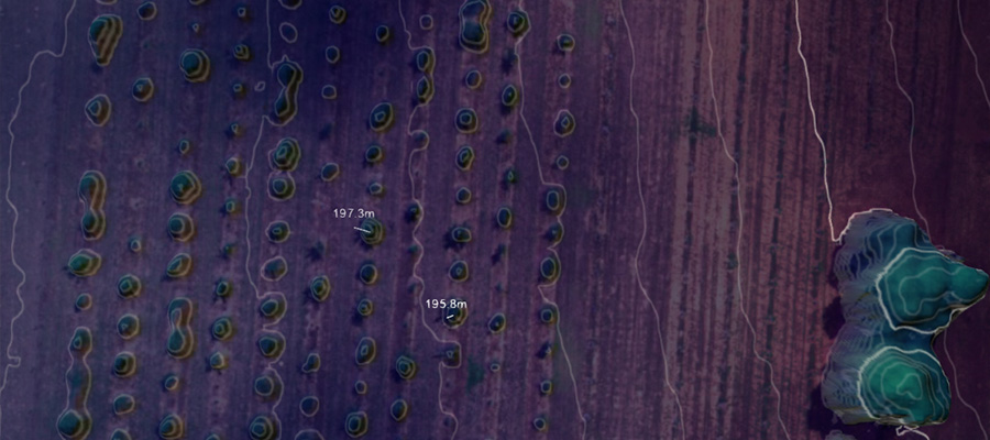
What you’re seeing above.
The contour spacing is 1 meter so each line represents a 1 m in elevation change (up or down). The elevation is displayed in the bottom right corner of the screen for the current mouse location. The 3D model is not perfect but it does give a good indication of tree height. If you slide the elevation overlay and the contour overlay you can see that the elevation estimate if very close to the actual tree canopy, with some smoothing errors around the edges. The type of information is typically used for automated tree counting and Leaf Area Index (LAI) calculations.
RIRDC suggest
Overview of Farm Mapping Software in Australia PDF 71 pages 15 Apr 2008
Overview of Farm Mapping, of software mapping packages for use by primary producers. It examines the range of software products, for primary producers to assess their needs, and the ability of mapping packages to meet their needs, overview of software mapping packages for use by primary producers. It examines the range of software, for primary producers to assess their needs, and the ability of mapping packages to meet their needs.
Warning: two of these suggestions are not being supported by the developers for new sales of the software.
Create a shadow map
There are some good online tools to tell where the shadows will be in your paddock, but the camera overlays made possible by mobile phone apps to help you locate the path of the sun all year round. Two of the best are:
Sun Surveyor Mac and Android
Sun Seeker (iPhone/iPad/Android) Sydney based company Ozpda Cost $10
Suncalc Android
These apps use your phones GPS and compass to display an accurate representation of the sun’s path through the sky in your location. they have 3D augmented reality camera overlays as well as integrations with Google maps.
Tech Recipes has a tutorial to show you how to find any sites latitude and longitude using Google maps.
Height above Sea Level
This is an important part of the ‘Can I grow truffles in this location?’ As you know, as you increase height above sea level your temperature drops so at the same latitude, you may be able to grow truffles with increased height of your plantation.
Again there are good smart phone apps that will help you find the high and low spots in your paddock.
OZpda have an iphone/ipad app for $4, on Itunes that uses GPS and checks it against Map altitude.
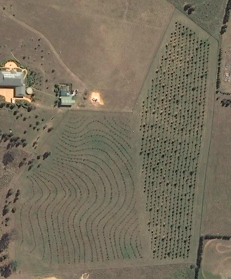
Google Earth view of Blue Frog truffière Sutton.
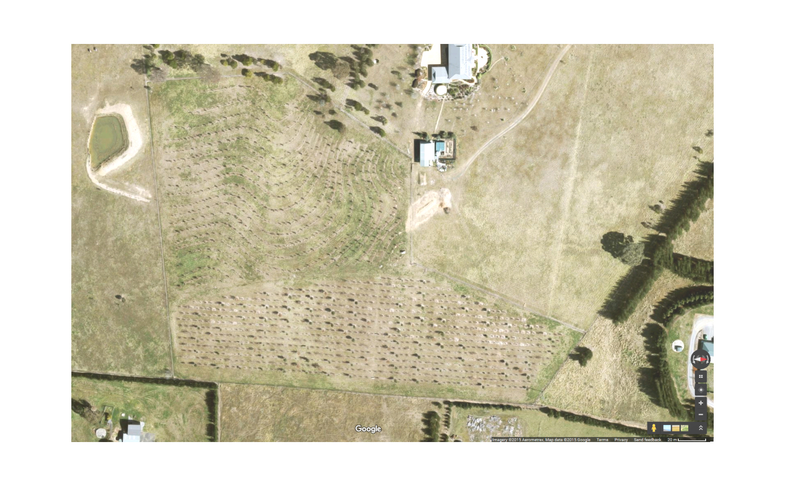
You could even create a simple 3D model of your truffière as in this vineyard example.
At the first Launceston Conference Nathan Carter (son of Colin) spoke about a database system he had developed for recording rainfall, soil quality, production quantities, productive trees by variety etc.
For the Princely sum of $100 I bought a copy from him.
A series of linked Excel spreadsheets with macros and summary pages.
Not rocket surgery, but beyond my modest capabilities at the time. I reckon I could improve on it with a little help.
Hideous colour scheme. Black backgrounds, blue, red and yellow text. Vile. That was the first thing that I fixed.
I have been pretty good recording the production but the weather data has been a bit hit and miss as our weather station died. Twice.
Richard Austen