There’s an offset on all the Climate Zone areas, especially east coast that needs fixing.
Using the treasure* map
Yes we know, a map like this covers a large area and you have a very small block. It won’t be any substitute to individual testing and research, but it might give you quick ‘Forget it!’ if you see the conditions are way outside what we suggest in our Site Selection pages.
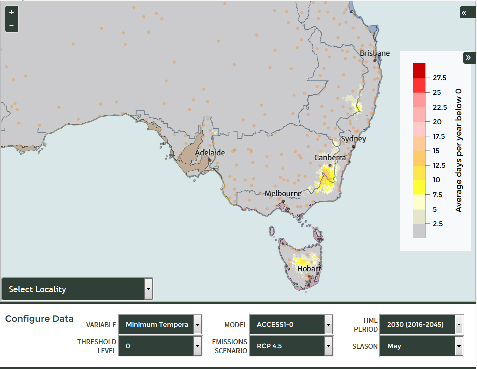
Start by searching for the location of your (intended) property. Zoom out (let it load, it’s including a lot of data) to look at surrounding areas, or use the grey Layers symbol ![]() to examine available characteristics or turn off that Climate Zones layer on top. You can turn on/tick just one layer or when all are overlayed, click on your set point, and there will be a pop with a > next arrow that steps through the data available for that area.
to examine available characteristics or turn off that Climate Zones layer on top. You can turn on/tick just one layer or when all are overlayed, click on your set point, and there will be a pop with a > next arrow that steps through the data available for that area.
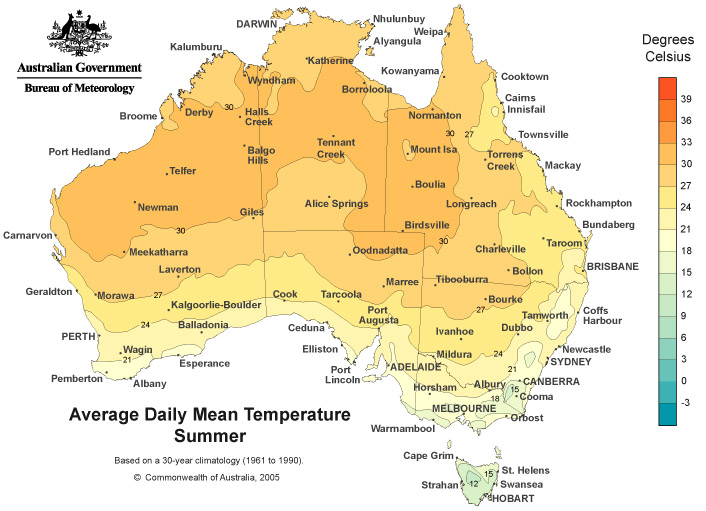
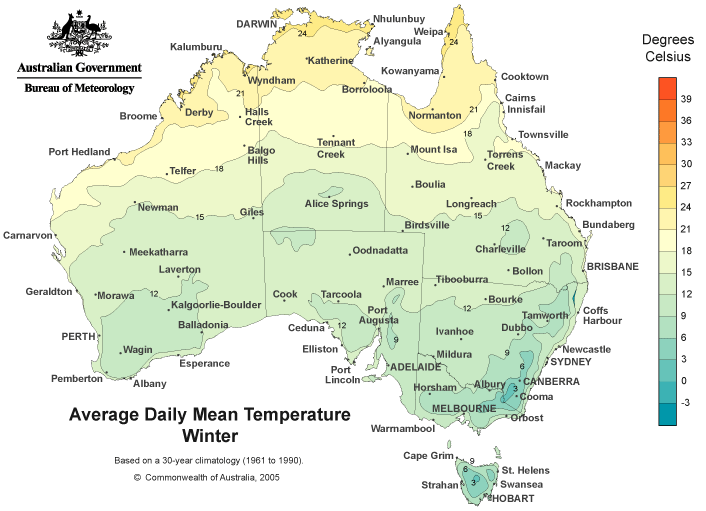
Remember you are looking for climate areas (Mediterranean was considered ideal, but now we know that areas marked ‘Marine’ can work), soil type (we know sandy loam is ideal, clay is not), pH (higher is better, 7.0 to 8.0) but you’ll still add a lot of lime so it probably doesn’t matter except for reducing the cost of modifying it, and temperature range (summer and winter averages – truffles need cold winters, warm but not prolonged hot summers). And then if there are good rainfall averages it will help fill your dam, as you’ll almost certainly irrigate in our dryer Australian summers.
View this WebMap App online full screen. Much easier to use. Map only.
The Rainfall Averages data is licensed from the Bureau of Meteorology correct at June 2016
![]()
* That’s Marcos Morcillo’s tongue-in-cheek term for his map of where truffles grow in Europe. If there’s treasure, there has to be pirates.


 This is the most recent guide. Produced in Spain (or rather Catalonia - there is a difference)